Bible Cartoon: Judges 06 - Gideon - Scene 10 - Alliance in Jezreel (without Dragonflies)
Click on Add to cart button below shopping cart.
Purchased Bible Cartoons do not have watermarks. Links to Cartoons provided on email once purchase is completed.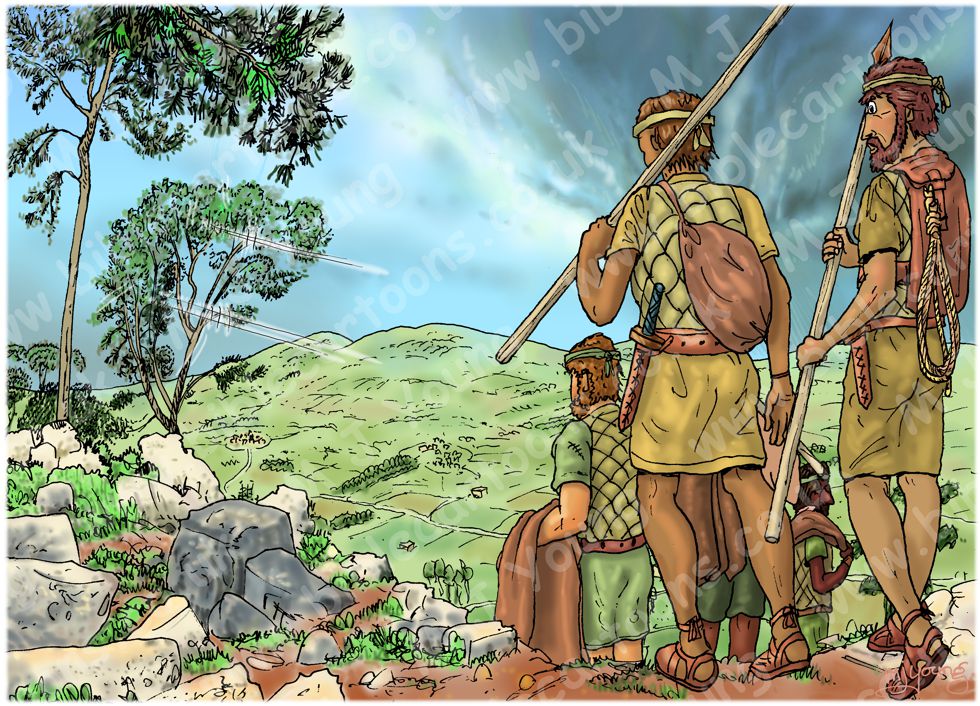


Bible Book: Judges
Bible Book Code: 0700603302
Scene no: 10 of 16
Bible Reference & Cartoon Description
Judges 6:33 (NLT)
Gideon Asks for a Sign
Soon afterward the armies of Midian, Amalek, and the people of the east formed an alliance against Israel and crossed the Jordan, camping in the valley of Jezreel.
DRAWING NOTES:
TIME OF DAY:
Unspecified in the Bible narrative. I have set this scene in the mid afternoon.
LIGHTING NOTES:
The sun (unseen, high on the left (West) illuminates this scene, casting shadows below and to the right of figures and objects.
CHARACTERS PRESENT:
Some Amelekite soldiers.
RESEARCH/ADDITIONAL NOTES:
There are two versions of this scene:
01) (Previous page) Judges 06 – Gideon – Scene 10 – Alliance in Jezreel (with Dragonflies).
02) (This page) Judges 06 – Gideon – Scene 10 – Alliance in Jezreel (without Dragonflies). The only difference between the two versions is the presence or absence of the two red Dragonflies.
This picture shows some Amelekite soldiers, carrying their weapons and supplies, making their way down the hillside of Mount Gilboa, heading into the Jezreel Valley (Valley of Megiddo). The view is from the summit of Mount Gilbea, looking towards the North West.
“The Valley of Jezreel, located between the Jordan River and the Mediterranean Sea, divides Galilee in the north from Samaria in the south. It is part of a larger valley that constitutes the only east-west passage across the Holy Land. It is also a fertile stretch of land that formed an important junction in the trade route between Egypt in the south and Damascus in the north. All of these factors, plus its relatively flat geography, have made it tremendously important and have contributed to its violent history.”
[Source: https://larshaukeland.com/bits-pieces/archeology/hosea/the-valley-of-jezreel-hosea-1/]
Here’s the scene without the figures or Dragonflies.
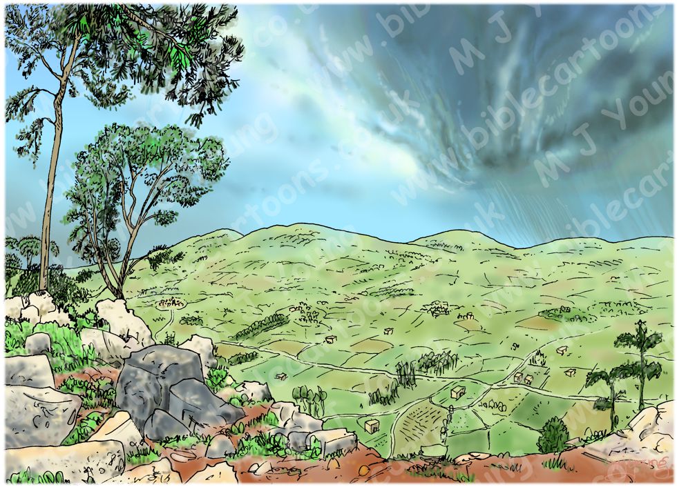
Background of Judges 06 – Gideon – Scene 10 – Alliance in Jezreel
Click on the colour bar below to view/buy this Background:
Background of Judges 06 – Gideon – Scene 10 – Alliance in Jezreel
The primary watercourses of the Jezreel Valley in northern Israel are the Kishon River (Nahal Kishon) and Nahal Harod, which act as the main natural drainage basins for the region’s winter rains and underground springs.
Here’s my map showing the Kishon River (Nahal Kishon) and Nahal Harod rivers in relation to the Jezreel valley. The red arrow is pointing towards Mount Gilboa.
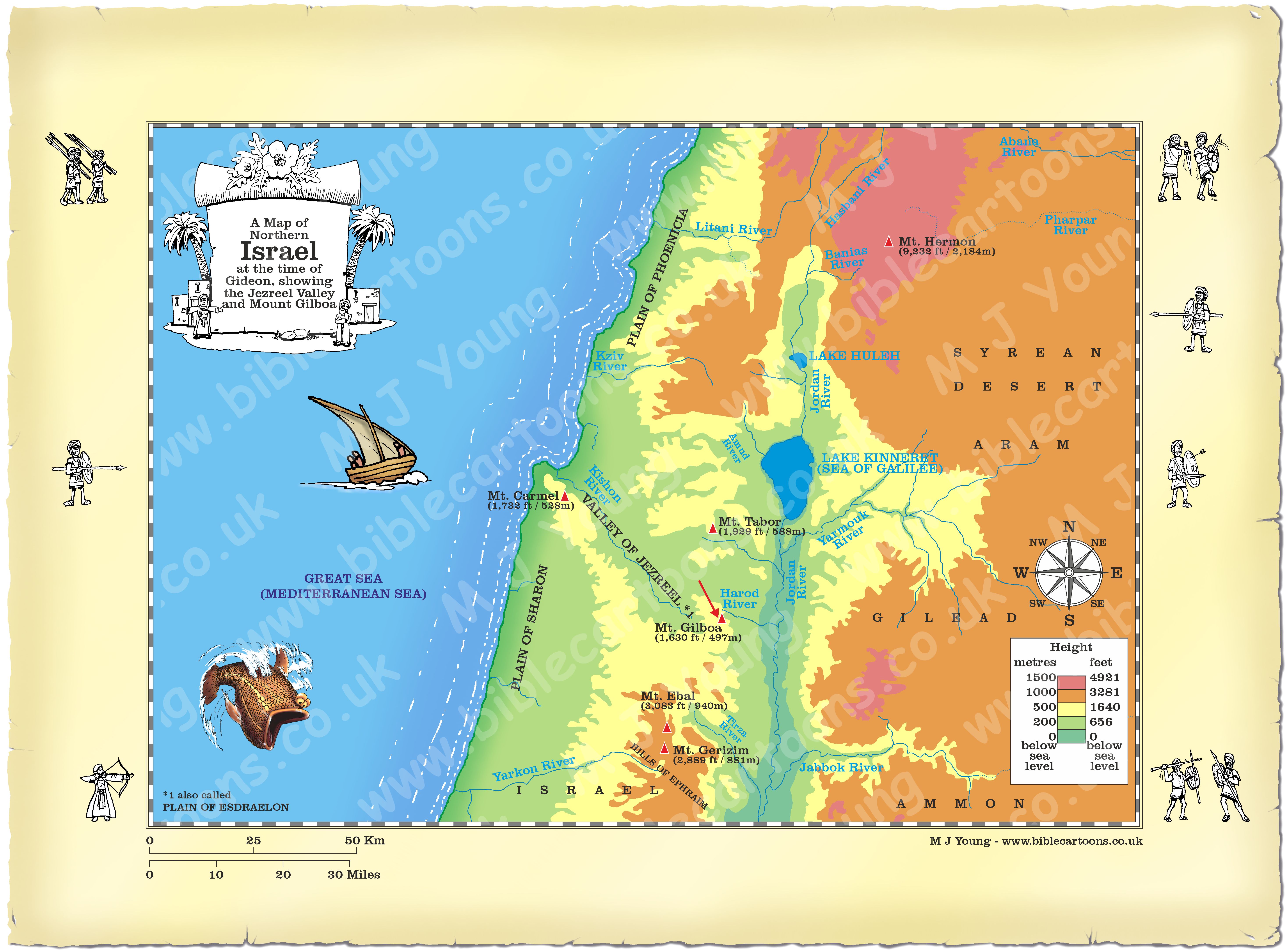
Map of Northern Israel showing Jezreel valley and Mount Gilboa
Link to related Map
Click colour bar below to see Map of Bethel with purchase option:
View/Buy this map
The Kishon River (Nahal Kishon) is a 43.5 mile (70 kilometre) perennial stream [1] in northern Israel. Originating in the Gilboa and Samaria mountains, it flows northwest through the Jezreel Valley and Mount Carmel ridge before discharging into Haifa Bay (Mediterranean sea). Its drainage basin spans 424 square miles (1,100 square kilometres).
Nahal Harod (also known as the Harod Stream or Wadi Jalud) is a 19.2 mile (31 kilometre) perennial waterway in northern Israel that flows west to east, acting as the primary drainage route for the Harod and Beit She’an valleys into the Jordan River. The Harod basin drains an 96.5 square mile (180 Square Kilometre) catchment area, passing through a 15.4 square mile (40 square kilometre) highly cultivated corridor that separates the western Jezreel Valley from the Jordan Valley.
[1]
The Kishon River exhibits classic Mediterranean wadi characteristics. The flow is intermittent during the dry summer but swells significantly from winter rainfall.
The red Dragonflies.
The two bright red dragonflies in my picture are Trithemis arteriosa (aka Red-veined Dropwing).
This dragonfly is found in and near a wide variety of slow-flowing and still-water habitats. These include streams, rivers, intermittent rivers, freshwater lakes, intermittent freshwater lakes, freshwater marshes, intermittent freshwater marshes, irrigation canals and ditches.
Trithemis arteriosa is widespread and common in most of its range which includes most of Africa and extends to western Asia and southern Europe.
The face of the mature male is deep red, the vertex and top of the frons [1] having a purple sheen. The eyes are deep red and the labium [2] deep yellow with a dark brown stripe in the centre. The synthorax [3] is red with black stripes; mature males often have a purple bloom on the upper thorax. The wings have bright red veins and orange makings at their bases. The pterostigmata [4] are 0.0906-0.0945 inches (2.3-2.4 millimetres) long and dark brown. The slender abdomen is bright red, while the females have similar markings, the abdomen and face are yellow to yellowish brown.
[Source: https://en.wikipedia.org/wiki/Trithemis_arteriosa]
[1]
The front part of an insect’s head capsule, essentially corresponding to the “forehead”.
[2]
In insects, the labium is the structure that acts as the lower lip. It closes the mouth from below and helps hold, manipulate, and taste food during feeding.
[3]
The synthorax (also known as the pterothorax) refers to the second and third segments of the thorax—the mesothorax and metathorax—when they are closely fused together into a single, solid structural unit.
[4]
A pterostigma (plural: pterostigmata) is a thickened, often pigmented, and opaque cell located on the leading edge (costal margin) near the tip of an insect’s wing.