Bible Cartoon: Acts 27 - Paul shipwrecked - Scene 04 - Sandy hope
Click on Add to cart button below shopping cart.
Purchased Bible Cartoons do not have watermarks. Links to Cartoons provided on email once purchase is completed.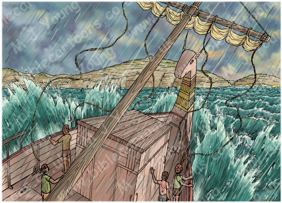


Bible Book: Acts
Bible Book Code: 4402703901
Scene no: 4 of 7
Bible Reference & Cartoon Description
Acts 27:39-40 (ANIV)
39 When daylight came, they [the sailors] did not recognise the land, but they saw a bay with a sandy beach, where they decided to run the ship aground if they could. 40 Cutting loose the anchors, they left them in the sea and at the same time untied the ropes that held the rudders. Then they hoisted the foresail to the wind and made for the beach.
DRAWING NOTES:
TIME OF DAY:
Verse 39 indicates this part of the story takes place around dawn.
LIGHTING NOTES:
The rising sun (on the right (East)) is illuminating the clouds behind the island in the distance and casting faint shadows to the left of the figures and ship in the foreground.
CHARACTERS PRESENT:
Various sailors on the ship.
RESEARCH/ADDITIONAL NOTES:
This scene shows the Alexandrian (Egyptian) ship nearing the island of Malta. The sandy beach the sailors observed (verse 39) can just be seen as a feint yellow strip, between the land and the rough waves, to the right of the island.
Notice that the rigging ropes which I drew in a previous scene (Acts 27 – Sea storm – Scene 03 – Lifeboat secured) haven’t been secured by the sailors and are still whipping around in the air!
Here is the scene without the figures in the foreground.
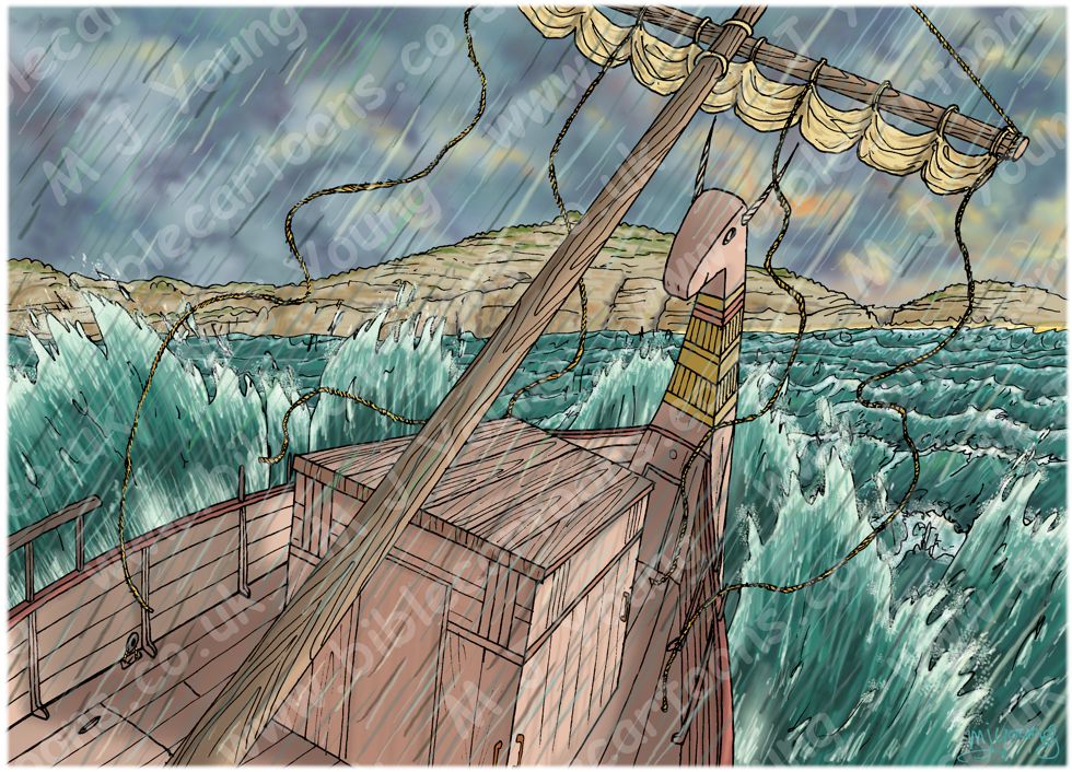
Background of Acts 27 – Paul shipwrecked – Scene 04 – Sandy hope
Click on the colour bar below to view/buy this Background:
Bible Cartoon: Acts 27 – Paul shipwrecked – Scene 04 – Sandy hope
Which bay on Malta did the Alexandrian (Egyptian) ship run aground in?
Traditionally scholars have believed that the site of the shipwreck (see verse 41) is on St. Paul’s Island, on the north coast of the island of Malta. The place is marked by a statue commemorating the shipwreck. However, there is a fascinating new idea & evidence to support an alternative location fro the shipwreck. Bob Cornuke, a US crime scene investigator has suggested a plausible alternate location, St. Thomas bay, on the south east of the island, as a more probable landing site for the stricken ship.
An article on the breakingchristiannews.com website has the details. here’s a link to that website: http://www.breakingchristiannews.com/articles/display_art.html?ID=9139
A BCN video, telling the story, can be seen here: http://www.cbn.com/tv/1425823708001
Geology of Malta
I am assuming that St. Thomas bay is the right location for the actual shipwreck (see articles & evidence above), & so have researched what the geology of that region is, to inform my drawing. The rocks of St. Thomas bay fall into the Middle Globigerina Limestone,
The geology of the Maltese Islands (Universiy of Malta)
https://www.um.edu.mt/science/physics/smru/generalinformation/geologyofmalta
http://users.aber.ac.uk/jpg/malta/geology.html