Shaded relief map showing Jerusalem city at the time of Nehemiah
Click on Add map to cart button below shopping cart.
Purchased Maps do not have watermarks, are high resolution (150dpi) & have crisp, clear labels/town names.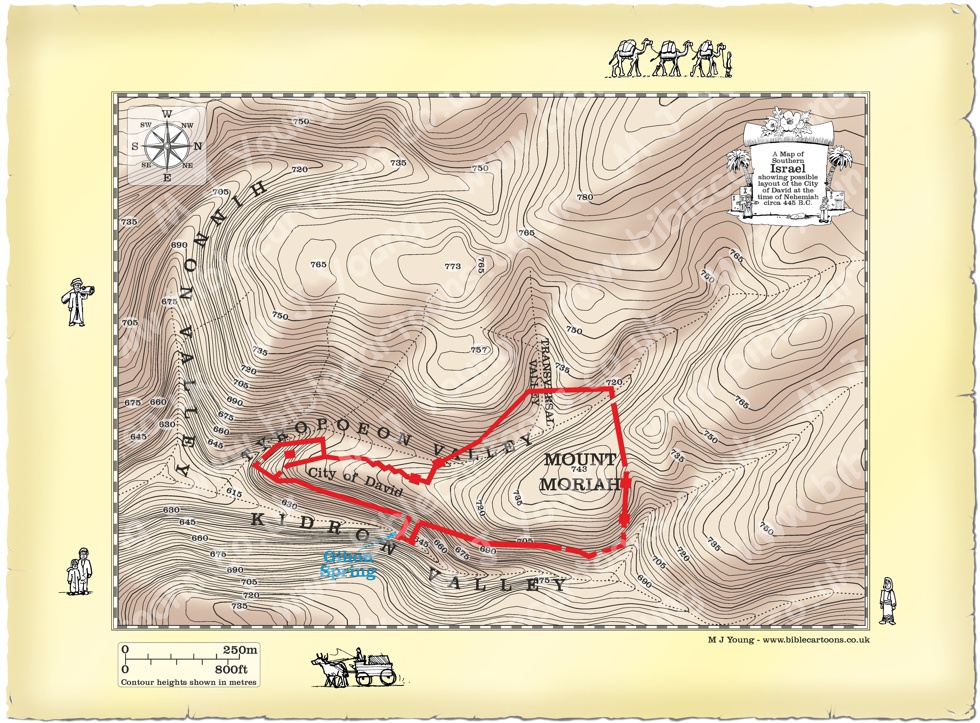
Bible Book: Nehemiah
Bible Book Code: 1600201103a
Bible Reference & Map Description
This is my shaded relief map showing Jerusalem at the time of Nehemiah.
Date
445 B.C.
Notice the figures on the border of the map.
If you look carefully at the map border you will see I have included some little black and white figures. I will add different figures to the borders of each map, adding characters that relate to the map subject.
Link(s) to related Bible Cartoons Blog
Click colour bar below to see the Bible Cartoon of Nehemiah going through the remains of the Valley Gate, at night, with his donkey and two companions, on the BC Gallery page, with download & purchase options:
Bible Cartoon: Nehemiah 02 – Nehemiah inspects Jerusalem’s walls – Scene 01 – Through the Valley Gate
Click colour bar below to read the BC Encyclopaedia article about the history of Jerusalem:
BC Encyclopedia: Jerusalem: Gates and Walls
Bible References
Nehemiah 2:11-13 (ANIV)
Nehemiah inspects Jerusalem’s walls
11 I went to Jerusalem, and after staying there three days 12 I set out during the night with a few men. I had not told anyone what my God had put in my heart to do for Jerusalem. There were no mounts with me except the one I was riding on. 13 By night I went out through the Valley Gate towards the Jackal Well and the Dung Gate, examining the walls of Jerusalem, which had been broken down, and its gates, which had been destroyed by fire.