Map showing the Persian empire with XY grid
Click on Add map to cart button below shopping cart.
Purchased Maps do not have watermarks, are high resolution (150dpi) & have crisp, clear labels/town names.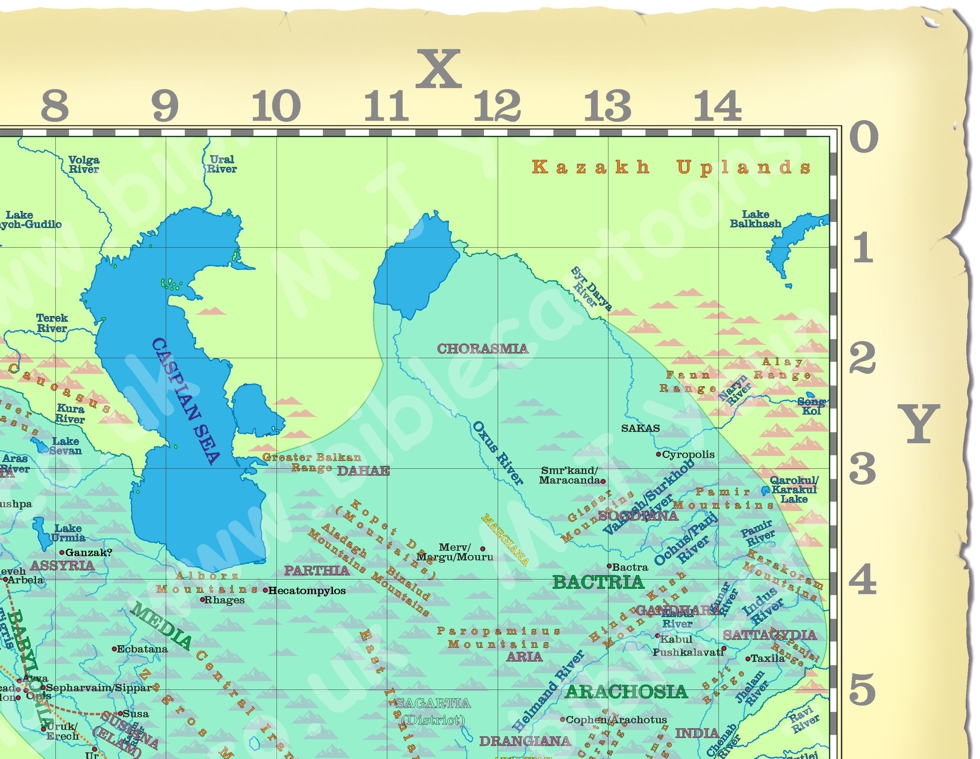
Bible Book: Ezra
Bible Book Code: 1500100102a
Bible Reference & Map Description
This map shows the extend of the Persian empire, around 500 BC, which was just after the second temple in Jerusalem had been completed which was in in 515 B.C.
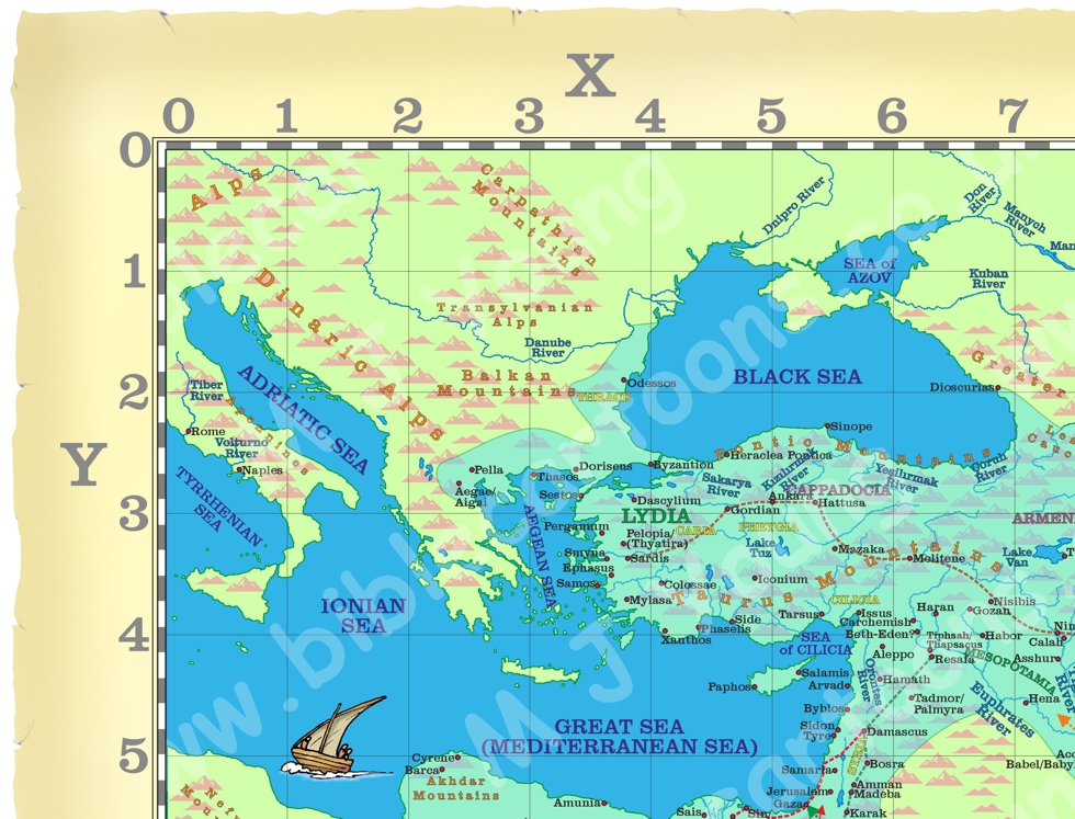
NW corner of Map of the Near and Middle East showing the Persian empire, with XY grid
Here’s a close-up of the NW corner to show the quality of the map you receive after purchase.
The purpose of the XY grid is to make it easier to reference a particular location on the maps, using XY co-ordinates.
This positioning system works best for locating small features (such as cities/towns), but is not so useful for larger features, such as long rivers, of mountain ranges. Nevertheless, it is still possible to refer to the North West (NW) quarter of the map, or the North East (NE), South West (SW) or South East (SE) quarters, and then refer to the XY co-ordinates of the name of a feature, in order to help someone to locate these larger features. For example, in the North West (NW) quarter of the map, at X 3.1/Y 1.7, is the named “Danube River”. The river flows from off the map (at X 0.3/Y0) to the Black Sea, at X4.2/Y1.2.
Date
During the 500s BC, key biblical events centred on the return of Jewish exiles from Babylon and the rebuilding of the temple in Jerusalem under Persian rule.
The Second Temple was completed in Jerusalem in 515 B.C.
The book of Ezra covers the period at the height of the Persian empire: the Bible Book of Ezra span from 538 BC to 457 BC.
Esther became queen of Persia in 478 B.C. nearly 25 years after the Persian empire reached its peak extend and power.
Link to Maps
Click colour bar below to view/buy all 6 of the matching BC Maps in the bundle:
BC Maps: Near and Middle East (Persian empire) bundle
Notice the figures on the map.
If you look carefully at the map border you will see I have included some little black and white figures. I have also added two figures in the bottom left hand corner, which represent typical Persian costume of the time.