Map of Sinai showing a possible route of Elijah from Jezreel to Mount Horeb
Click on Add map to cart button below shopping cart.
Purchased Maps do not have watermarks, are high resolution (150dpi) & have crisp, clear labels/town names.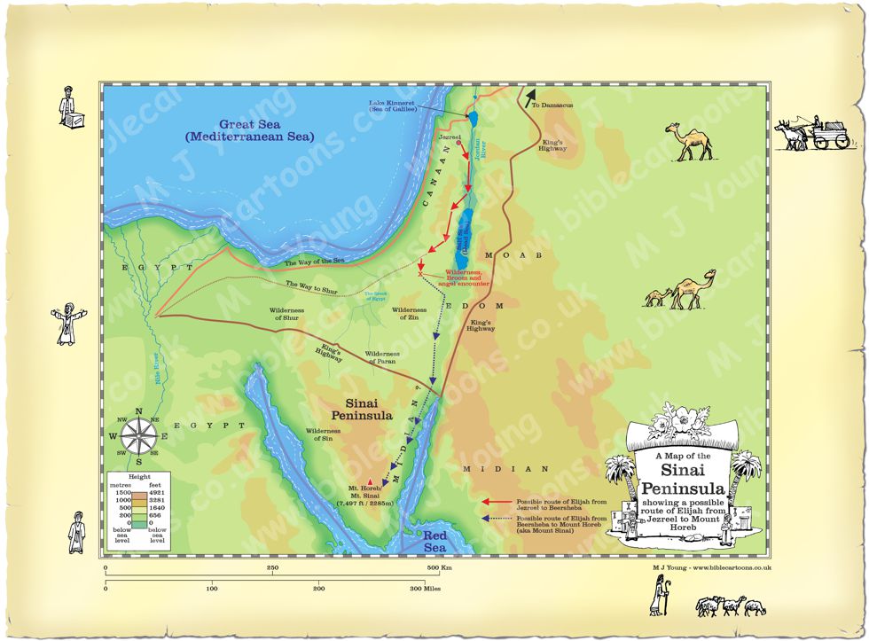
Bible Book: 1 Kings
Bible Book Code: 1101900301a
Bible Reference & Map Description
This is my map of the Sinai peninsula showing a possible route the prophet Elijah may have taken to elude Jezebel’s spies. He hurried away from the city of Jezreel in the north, to Beersheba, in the south. After an encounter with an angel, he journeyed for forty days and nights and ended up at the mountain of God: Mount Sinai, also known as Mount Horeb.
Date
9th century B.C.
Notice the figures on the border of the map.
If you look carefully at the map border you will see I have included some little black and white figures. I will add different figures to the borders of each map, adding characters that relate to the map subject.
Link(s) to related Bible Cartoons
Click orange bar below to see the Bible Cartoon of Elijah under the broom “tree” in the wilderness near Beersheba, on the BC Gallery page, with download & purchase options:
Bible Cartoon: 1 Kings 19 – Elijah flees to Horeb – Scene 02 – Broom desperation