Map of Sinai peninsula showing Mount Sinai
Click on Add map to cart button below shopping cart.
Purchased Maps do not have watermarks, are high resolution (150dpi) & have crisp, clear labels/town names.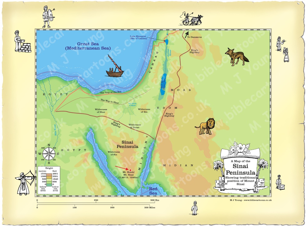
Bible Book: Exodus
Bible Book Code: 0201900101a
Bible Reference & Map Description
This is my map of the Sinai Peninsula, showing the traditional position of Mount Sinai.
Date
According to the biblical narrative, the Israelites arrived at Mount Sinai on the first day of the third month following their departure from Egypt. This corresponds to exactly 45 to 47 days after the Exodus. Historically, this arrival is dated by many scholars and theologians to 1446 B.C., while some secular and critical scholars favour a later date around the 13th century B.C.
Notice the figures on the border of the map.
If you look carefully at the map border you will see I have included some little black and white figures.
Link(s) to related Bible Cartoons
Click orange bars below to see the Bible Cartoons that relate to the Exodus of the Hebrew people from Egypt, on the BC Gallery page, with download & purchase options:
Bible Cartoon: Exodus 19 – Mount Sinai – Scene 06 – Trembling
Bible References
Exodus 19:1-2 (NIV)
On the first day of the third month after the Israelites left Egypt—on that very day—they came to the Desert of Sinai. 2 After they set out from Rephidim, they entered the Desert of Sinai, and Israel camped there in the desert in front of the mountain.