Valleys: The Five Key valleys of the Shephelah in Israel
The five major east-west valleys that run from the low-lying coastal plains to the Judean highlands (the Shephelah transition zone) in Israel are the Ayalon, Sorek, Elah, Guvrin and Lachish Valley.
These valleys cut transversely across the foothills, serving historically as vital trade routes and ascent corridors from the Mediterranean coast up to the central mountain spine.
The Five Valleys (North to South)
Ayalon Valley:
Located in the north, it provides access toward the upper ridges leading north of Jerusalem. Follow this link to see the BC Encyclopaedia article about “Ayalon/Aijalon, valley of”:
Ayalon/Aijalon, valley of
Sorek, valley of
Positioned centrally, it offers a direct route up into the Jerusalem hill country. Follow this link to see the BC Encyclopaedia article about “Ayalon/Aijalon, valley of”: Sorek, valley ofElah, valley of
Famous historically as the site of David and Goliath’s battle, it leads up toward the area near Bethlehem. Follow this link to see the BC Encyclopaedia article about “Elah, valley of”: Elah, valley ofGuvrin, valley of
Situated further south, it cuts through the lower hills without providing a direct major pass into the high mountain spine. Follow this link to see the BC Encyclopaedia article about “Guvrin, valley of”: Guvrin, valley ofLachish, valley of
The southernmost of the major transverse valleys, it connects the coastal lowlands up toward the region of Hebron. Follow this link to see the BC Encyclopaedia article about “Lachis, valley of”: Lachish, valley of
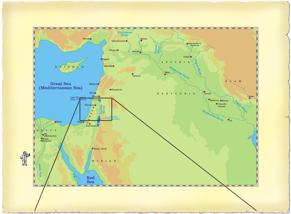
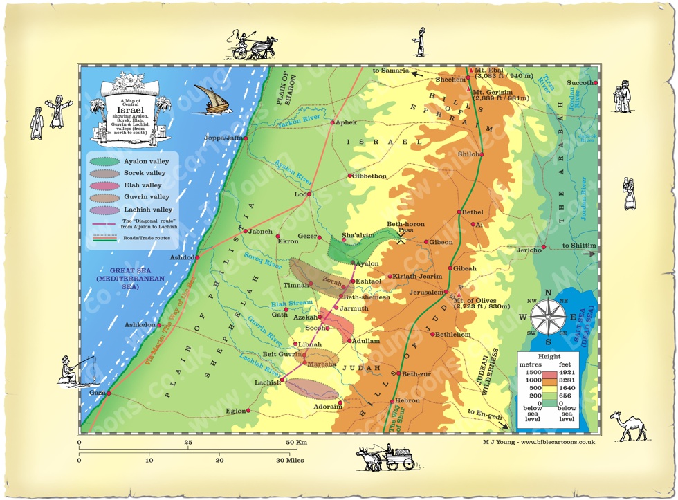
Large Scale map of Central Israel showing 5 main valleys with roads/trade routes
Link to related Map
Click colour bar below to see Map of Central Israel showing the 5 main valleys with roads/trade routes, with purchase option:
View/Buy this map
Getting from the coastal plain to Israel’s highlands, through the Shephelah (Judean foothills).
The unique geography of the Shephelah (the Judean foothills) created a natural defensive barrier that dictated every ancient military campaign between the coastal plains and the Judean highlands. This geography also formed the trade routes used by ancient caravans for centuries, focusing movement mainly through the five key valleys.Because the high mountain spine of Judea was surrounded by steep, rugged cliffs on the north, south, and east, these five east-west valleys were the only viable highways for an invading army (for example, the coastal dwelling Philistine people, long-time enemies of the Hebrew people).
The Coastal Plain is a flat, sandy-to-alluvial region starting on the coast of the Mediterranean Sea and historically hosting major international trade routes (e.g the Via Maris or the “Way of the Sea”).
The Longitudinal Trough is a distinct intermediate depression or trench carved through soft chalk separating the hard limestone mountain spine from the lower rolling hills.
The Shephelah is the transitional region of low rolling hills and natural east-west corridors (the 5 key valleys) connecting the Mediterranean Coastal Plain to the high Judean Mountains. The Shephelah is composed of soft Eocene limestone and low rolling hills stretching 6.2 to 9.3 miles (10 to 15 km) wide, and acts as a stepped buffer zone.
Invading armies were forced off the flat plains and funnelled into the five key, narrow valley chokepoints. Foothill fortresses allowed Israelites to spot invaders days before they could move towards Jerusalem.
Links to the five key valley articles in the BC Encyclopaedia.
Follow this link to see the BC Encyclopaedia article about the northern most Ayalon valley:
Ayalon/Aijalon, valley of
Follow this link to see the BC Encyclopaedia article about the northern most Ayalon valley:
Sorek, valley of
Follow this link to see the BC Encyclopaedia article about the northern most Ayalon valley:
Elah, valley of
Follow this link to see the BC Encyclopaedia article about the northern most Ayalon valley:
Guvrin, valley of
Follow this link to see the BC Encyclopaedia article about the northern most Ayalon valley:
Lachish, valley of
Return to BC Encylopaedia Index page