Map of Southern Israel showing journey of Abraham and Isaac from Beersheba to Moriah
Click on Add map to cart button below shopping cart.
Purchased Maps do not have watermarks, are high resolution (150dpi) & have crisp, clear labels/town names.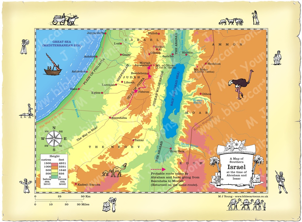
Bible Book: Genesis
Bible Book Code: 0102200101a
Bible Reference & Map Description
This is my map of Southern Israel, showing the probable route taken by Abraham and his son Isaac, when they travelled for three days from Beersheba to Moriah, which is just north of the ancient city of Jebus. This journey is outlined in Genesis chapter 22.
Date
While the exact calendar date is unknown, traditional biblical chronologies (such as Ussher’s [1]) place the event around 1871 B.C.
Notice the figures on the border of the map.
If you look carefully at the map border you will see I have included some little black and white figures.
Link(s) to related Bible Cartoons
Click orange bar below to see the Bible Cartoon relating to the Negev, on the BC Gallery page, with download & purchase options (Note there are two versions of the scene to choose from):
Bible Cartoon: Genesis 22 – Abraham and Isaac – Scene 03 – Sacrifcie (Version 01)
Click orange bar below to see the Bible Cartoon relating to the Negev, on the BC Gallery page, with download & purchase options (Note there are two versions of the scene to choose from):
Bible Cartoon: Genesis 22 – Abraham and Isaac – Scene 03 – Sacrifcie (Version 02)
Bible References
Genesis 22:2 (NLT)
Abraham’s faith tested
2 “Take your son, your only son—yes, Isaac, whom you love so much—and go to the land of Moriah. Go and sacrifice him as a burnt offering on one of the mountains, which I will show you.”
[1]
a 17th-century timeline created by Irish Archbishop James Ussher.